Document
Identifier:
M-0046
Description
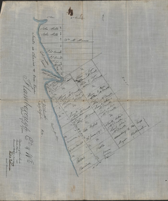
Flamborough East and West, District of Gore
Additional Information
This item consists of a map of surveyed land and property in East and West Flamborough. It lays out property lots by number, and includes the names of the contemporary owners. It also contains a sketch of Coote's Paradise and Burlington Bay.
Physical Description
1 map
Date:
February 1881
Creator:
Thomas H. Johnson, Assistant Commissioner, Department of Crown Lands